Jeffreys Cliffs

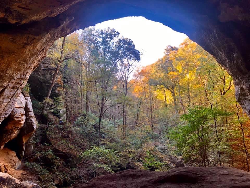
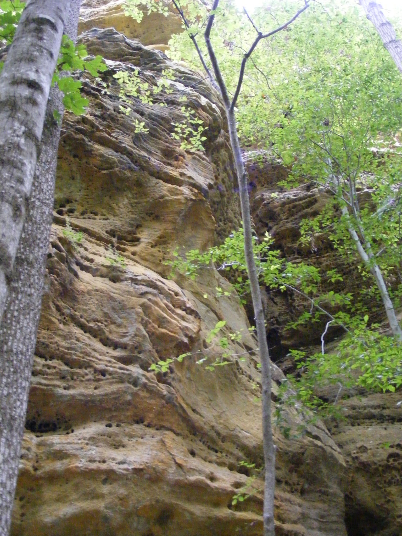
Jeffreys Cliffs Conservation & Recreation Area in Hawesville boasts 230 acres of forests, with topography and geological features not typically found in that part of the state—rock shelters, cliff overlooks and a sandstone plateau covering more than 90-acres. Steve Canepari, Hancock County Heritage Commission president, describes it as being “like an island.”
“There’s nothing like it in western Kentucky,” he says.
Prior to the late 1870s, the property was listed on land deeds simply as The Big Cliffs. Then in 1873, English immigrant Dr. John Augustus Jeffreys acquired the cliffs, blasted a wagon road to the top on the north side, and built a home there with his wife, Elizabeth Boone, great-niece of Daniel Boone. The couple and their 11 children (only six survived to adulthood) lived there until 1898—hence the name Jeffreys Cliffs. Today, a small pond and intact cistern are all that remain from the time the Jeffreys family made their home on top of the cliffs in the late 19th century.
Most recently, Hancock County native Jerry Harris owned Jeffreys Cliffs. Upon his passing, he donated the property with the caveat that it must be used for the public’s enjoyment. Harris’ daughters traveled from Alaska to meet with local officials to ensure that happened.
Canepari was selected to explore ideas on how to best use the property. But with no direct access to it, the Hancock County Heritage Commission’s first task was acquiring an adjacent farm with the help of the Office of Kentucky Nature Preserves and the Kentucky Heritage Land Conservation Fund. Though the project began in 2014, it wasn’t until six years later, in 2020, that Jeffreys Cliffs finally opened to the public. “The rest, as they say, is history,” adds Canepari.
For nature enthusiasts, there’s plenty to see and do along the 6 miles of hiking trails. The lower trail consists of two loops, one leading to the massive Morgans Cave that’s several hundred feet wide, 180 feet tall, and 150 feet deep. During the Civil War, it was a hideout for Confederate guerillas and the grave site of at least one known soldier.
Canepari shares a tale of the demise and burial of the infamous Hancock County Confederate guerilla Bill Davison: “He was buried up there for 30 years. They hid his body out after he was killed in an ambush right at the end of the war. They didn’t want somebody to claim the reward. He was eventually dug up by some friends and moved to Hawesville Cemetery.”
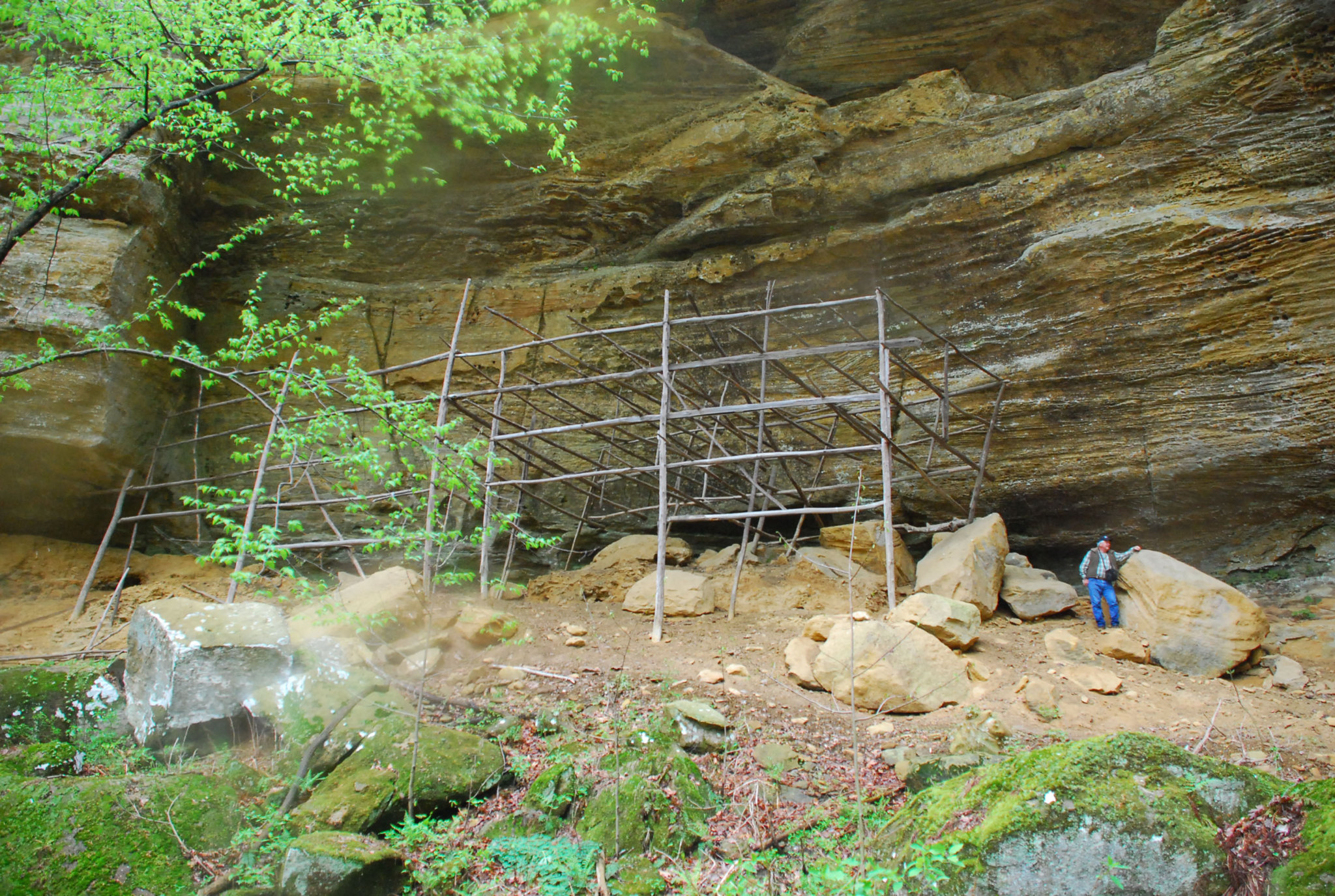
The second lower trail loop leads to Tobacco Cave, also with historic ties. “We gave it its name because once upon a time, back in the 1940s, somebody tried to use it to house tobacco they were growing,” explains Canepari. “And the structure that they built back in the ’40s is still there.”
The upper trail, accessed by a set of steps at the Mossy Gap crevice, leads to five overlooks—Devils Point, Troop 36 Point, Mossy Gap and Lookout Point on the west side, plus East View to the east—all featuring breathtaking views of the surrounding countryside and the winding Ohio River.
Canepari and a group of volunteers recently finished a second series of stairs and ladders that enable hikers to climb to or ascend from the upper trails at Troop 36 Point. “You can now hike the upper trails and enter or exit separate ways. Sort of a loop,” explains Canepari.
Though every season offers hikers something new to explore, October brings the most visitors to Jeffreys Cliffs as the foliage turns to red and gold, ushering in the autumn season. “It’s just a unique and beautiful place,” says Canepari. “I know why Dr. Jeffreys wanted to live up there.”
Jeffreys Cliffs Conservation & Recreation Area:
715 Williamette Road., Hawesville
(270) 927-9794 (Note: Leave a message; calls will be returned.)
Facebook: Jeffreys Cliffs Conservation & Recreation Area
Hours: Open daily from sunrise to sunset. Free to the public. No picnicking, no camping and no pets allowed. Portable bathrooms on-site. Maintained by volunteers and served by Kenergy. Guided tours available for school groups, fourth grade and up. Find hiking trail maps on their website.
Photos: Steve Canepari